
Checking Calculation Result
This section introduces how to modify the relevant parameters of the area and check the IRR distribution level in sub-areas of this area.
- Click the check box of the area object in the project pane.
- Click Layer Edit on GIS to expand the layer edit pane.
-
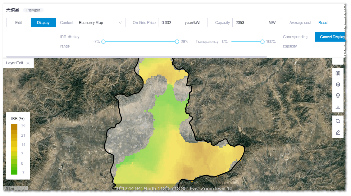
Click the Display tab to check the map analysis
result.
According to the parameters defined in the Map
Analysis panel, the on-grid power price is loaded automatically,
and the capacity and cost are calculated.
-
(Optional) Modify the price, capacity, and cost.
The customized cost is taken as the average cost within the area. Combined with this customized cost and the Greenwich mesoscale wind speed and terrain data, the system adjusts and calculates the cost of each point in the area and projects the IRR level of each point.
- Drag the IRR display range slider to adjust the IRR display range. The corresponding capacity sum within the defined IRR range is displayed at the right side of the slider.
- (Optional) Click Reset to restore to the default settings.
- Click Display to display the IRR distribution corresponding to the defined parameters. By analyzing the economy condition under various parameters, the target areas for further evaluation and siting are located.