Version 10.5.0
Greenwich v10.5.0 has been released.
Main updated modules are:
- AEP Calculation - Real Frequency
- Load assessment wind condition
- Map
Please check the user manual via this link.
For more information, please check the following content:
AEP Calculation - Real Frequency
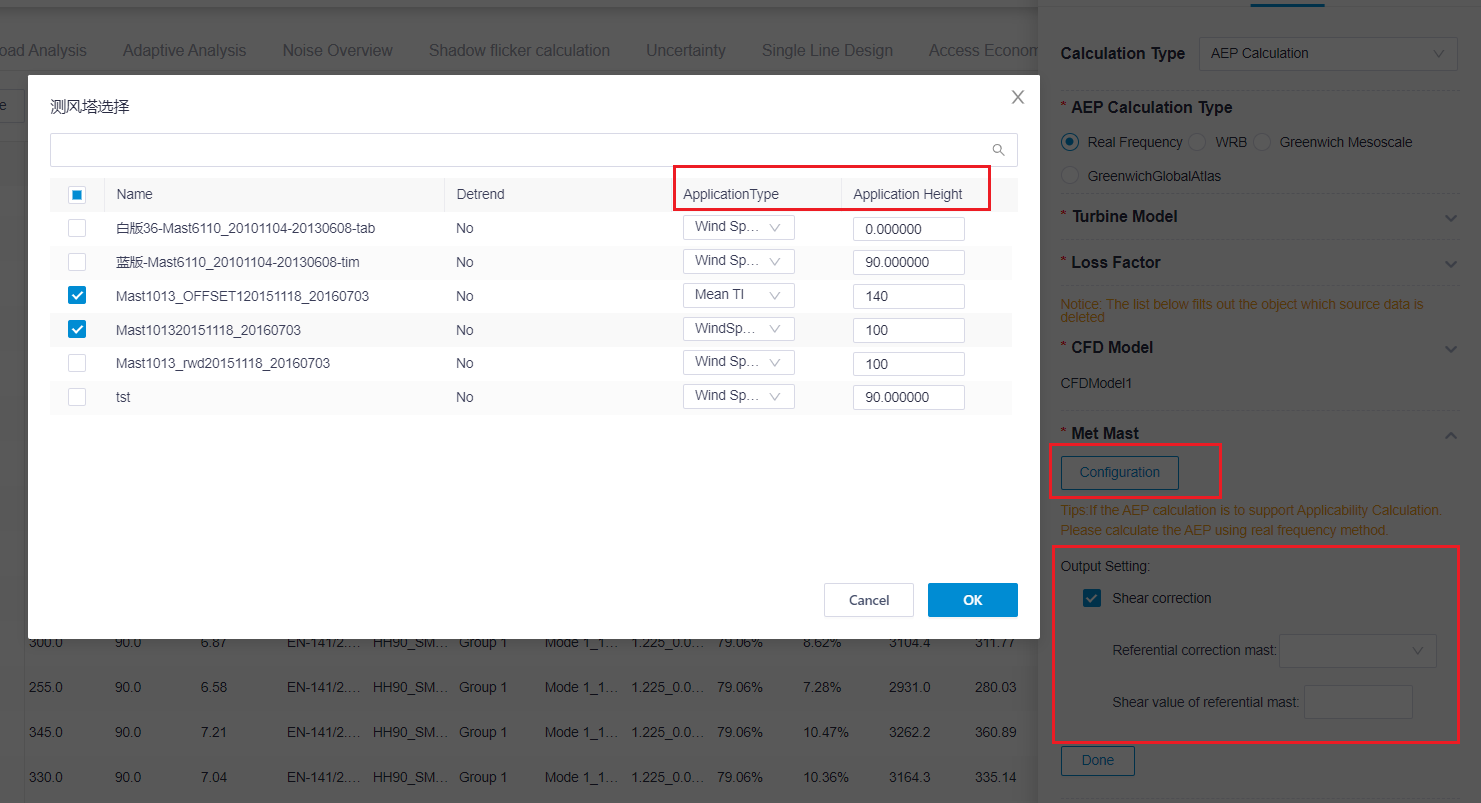
Add a Configuration button to the Met Mast section. Click Configuration, select mast/masts in the pop-up window, and specify the Application Type and Application Height. Application Type includes Wind Speed, Mean TI, WindSpeed and Turbulence. Additionally, you can enter keywords in the search box to search for masts.

In Met Mast Output Setting, you can check Shear correction, and then select the Referential correction mast, and input the Shear value of referential mast. The system is based on the shear correction model of the reference point and improves the accuracy of the load adaptability analysis.
Add a new Output Setting section, which includes options related to AEP and Load assessment wind condition. Check the relevant options to export the corresponding files for viewing on the Overview and Load assessment wind condition pages.

For detailed information, refer to Calculating AEP - Real Frequency.
Load assessment wind condition
- Load Analysis is updated to Load assessment wind condition.
- Add Display content options that include Mean TI and Shear.
- In Turbulence exceedance probability, add another option PXX(XXMean TI) to select other Mean TI values.
- Add Wöhler curve exponent options. When PXX(XXMean TI) is selected, the value can be customized.
- When the options in the Load assessment wind condition category is checked in the Output Setting of real frequency AEP Calculation, you can click Download wind distribution and turbulence matrix, Download SSDA wind condition, and Download IEC topographical complexity details to export the corresponding files.
For detailed information, refer to Analyzing Turbine Load.
Map
Add the Enhanced Display function for Topography content. When Topography is selected in the content, you can set a filter condition in Enhanced Display to display only the topography information within the filter condition. Click the Reset button to return to the original map display.
Note
The minimum value set in the filter condition is -1000 and the maximum value is 8000.
For detailed information, refer to Checking Terrain and Roughness.