
Map Layers
Map layers are consisted of satellite map, simplified map, road network map, contour map, and roughness map. The main sources are Google and Tianditu. These maps enable you to compare the details of maps, in order to increase the accuracy of wind farm planning and designing.
- Click the map layer icon
 in the toolbar menu. The map layer pane is expanded.
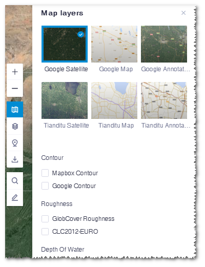
- Click the map layers to display them in GIS.
The maps include Google satellite map (map based on Google satellite image), Google map (simplified map with main roads and without image; it is mainly used in road design), Google annotations , Tianditu satellite map, Tianditu map, and Tianditu annotations.
The default view is Google satellite map.
- Select contour and roughness map and depth of water to view the terrain, roughness,
and the water depth map. The following maps are included: Mapbox contour, Google contour, GlobCover roughness map (global terrain map from GlobCover with resolution ratio as 300 m), CLC2012-EURO (roughness map of Europe), depth of water.Note: Annotation maps and roughness maps and depth of water can be displayed over the other maps.