
Information Demonstration Area
Information demonstration area is to demonstrate information such as map, road network, terrain, roughness, turbine and mast location. In addition, the operation panel of each module is opened in this area, providing options and parameters of some specific objects.
The default view of information demonstration area is Geographical Information System (GIS). This section introduces each part of GIS. For details of the operation panels, refer to the sections for macrositing, planning and siting, EBA calculation, and other modules.
| No. | Name | Description |
|---|---|---|
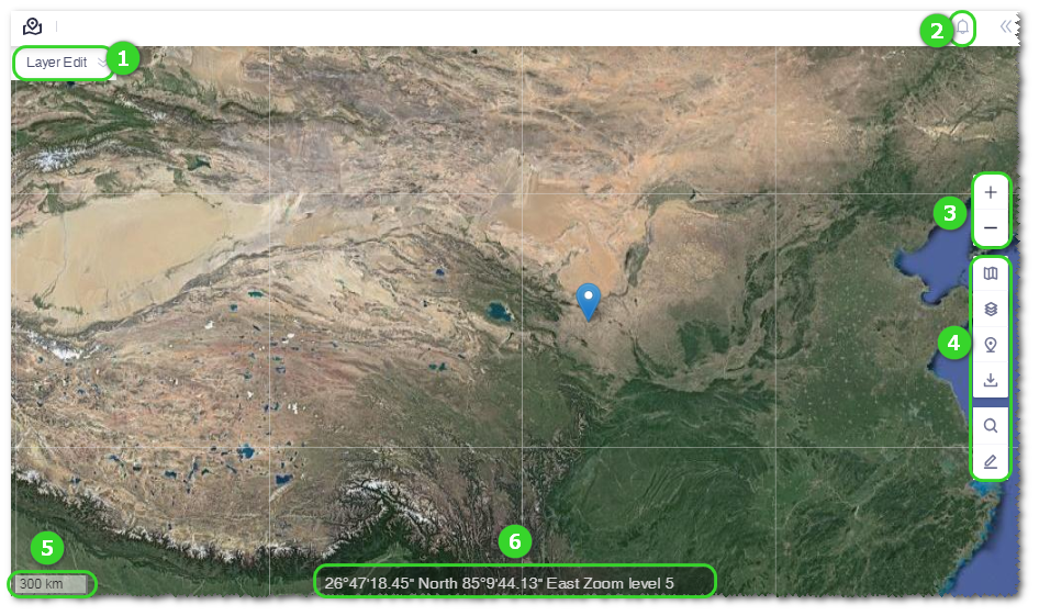
| ① | Layer editor | This editor is displayed only when the specific object in Project tree is
selected. The specific object should be map, CFD model, wind resource grid, WTG group,
noise map, and wire, route and platform scheme. Expand the editor panel, select the corresponding tab, and select the content of object to be displayed in GIS. For more details, check the relative content in the CFD model, macrositing, noise, or platform design sections. |
| ② | Message pane | Click the icon  to
open the message pane to check the task status and system notifications (including
version upgrade and database update). If new task status or notification appears, a
red dot will pop up at the right top of this icon. to
open the message pane to check the task status and system notifications (including
version upgrade and database update). If new task status or notification appears, a
red dot will pop up at the right top of this icon. |
| ③ | Scaling | Click + or — to zoom in or out the map. Click the scaling button once, the map is zoomed in or out by one level. |
| ④ | Toolbar menu | Operation tools used for GIS are collected here, such as map layers |
| ⑤ | Proportional scale | Display the resolution ratio of the current map. |
| ⑥ | Cursor information | Display the longitude, latitude, and scaling level of the cursor point. |